 array(0) {
}
array(0) {
}
Dolly Sods Bridge Closed Temporarily
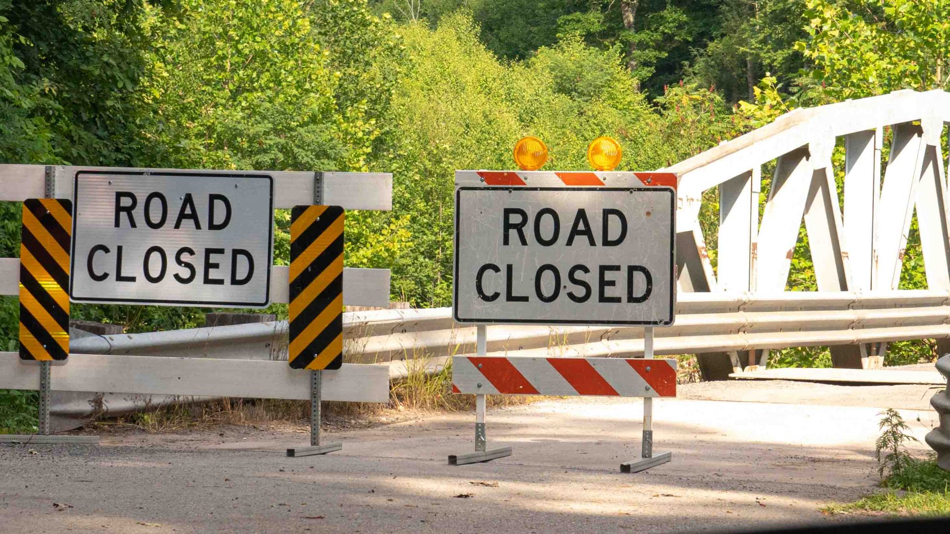
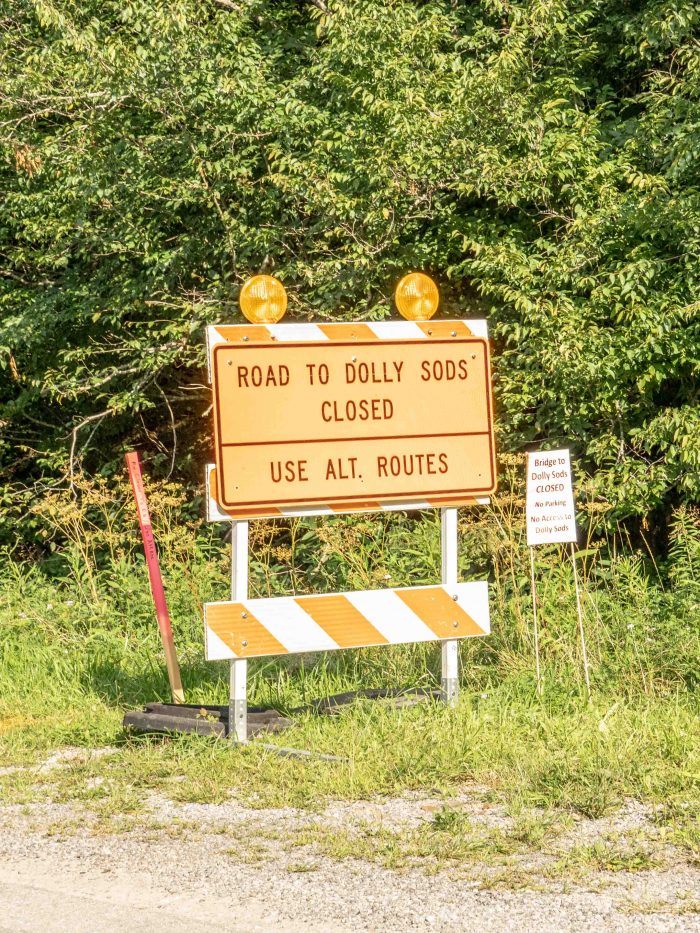
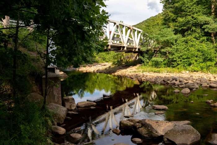
August 10, 2022As of August 1st, 2022, the US Forest Service Bridge to Dolly Sods Wilderness at the wilderness areas Lanesville entrance has been temporarily closed. The immediate closure is due to a failed bridge inspection. A temporary bridge plan is in the works, however a timeline for completion is unknown.
We will keep you posted on updates through our website and newsletters, as well as our social media channels on Facebook and Twitter. The USFS will also continue to post updates as they become available on their website at https://www.fs.usda.gov/mnf. You may also contact the Petersburg office at (304) 257-4488 for assistance.
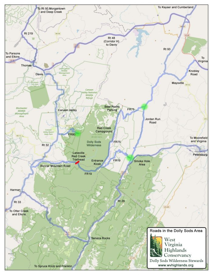
While the closure is disruptive, there are still three ways of accessing Dolly Sods by vehicle.
From Canaan Valley use Forest Road 80 (FR 80), which is at the end of Freeland Road off of RT. 32. Freeland Road is used in winter by skiers going to White Grass Cross Country Ski Resort. This part of Dolly Sods is traditionally used by hikers and backpackers as there are no easily accessible overlooks or places of convenient interest here.
Overnight parking is allowed at the FR 80 parking lot by PERMIT ONLY from the Canaan Valley National Wildlife Refuge. On big weekends you will want to arrive early in the morning as parking has its limitations here.
To access what would be considered Dolly Sods’ main attractions you will now need to drive one of two ways. From either Seneca Rocks (Rt.28) to the south or Scherr (Rt. 93) to the north via highway US 48. If driving from Seneca Rocks, take Rt. 28 north until taking a left onto Jordan Run Rd. Continue on Jordan Run Rd. looking for Forest Rd. 19, again on the left. FR. 19 is the road to Dolly Sods.
Driving from Scherr, take Rt. 93 south twelve miles until reaching Jordan Run Rd. Take a right onto Jordan Run Rd and continue approximately 5 miles until taking another right onto Forest Road 75. From here continue on to Bear rock Preserve and Dolly Sods Wilderness.
By utilizing both Forest Roads you can make a loop of Dolly Sods and the Allegheny Front. This is actually a very convenient way of seeing the wilderness area while not having to backtrack. A map has been made by some of the stewards of Dolly Sods for our convenience and is found at the very end of our blog.
Regardless of what direction you choose to drive, the times are nearly identical to driving the traditional Lanesville route. Leave an hour for travel time one way. While taking the southern detour, it will be convenient to spend time at Seneca Rocks or Smoke Hole Caverns, and visit West Virginia’s highest peak, Spruce Knob.
Look at the temporary detour of Red Creek Bridge as an opportunity to explore new places and check out the variety of scenery wild and wonderful West Virginia has to offer. As soon as there is an update, we will let you know. Until then, have a great end-of-summer and #gettuckered!
Cheers,
Brian